Here's a glacier:
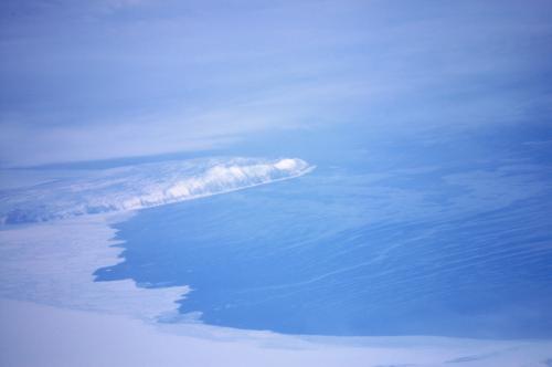
Nikon D100, 75-240mm
Here's some sea ice along Alaska's western coast:
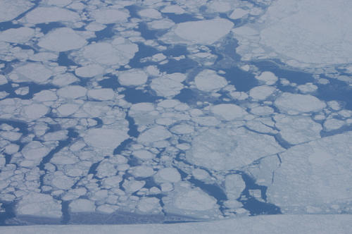
Nikon D100, 18-35mm
It goes on forever:
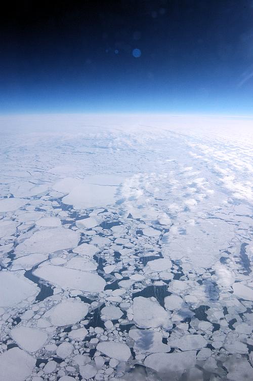
Nikon D100, 18-35mm
Here's some unidentified island, wrapped in ice, with a few thin clouds overhead:

Nikon D100, 18-35mm
But how do I know that's Alaska? This is how:
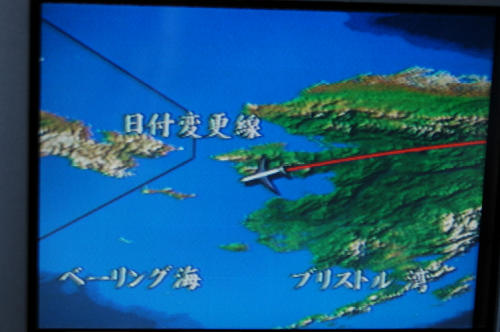
Nikon D100, 18-35mm
Soon, we will arrive (8 hours of flight time down, 6 to go).
Holy canole, where did you go?!
Guessing by the horizon photo it looks like you went to space or something. Did you edit that photo or could you really see that from the plane?
Anyways, very interesting series and photos, thanks! Looking forward to the rest.
Yeah, you flew right over Gates of the Arctic National Park and Bering Land Bridge National Preserve, two of the remotest spots in the National Park Service (www.nps.gov). No roads into em, and in winter they are inaccessible by plane as well. Considered by some to be the nation’s most difficult terrain. If you pick up The Rough Guide to Alaska (one of the best books I’ve ever read, oddly enough) you will hear all about their miserable remoteness. You also would’ve flown over Little Diomede Island on the Russian/US ocean border. Quite impressive, man.
I would fly to Tokyo just for that view. You’re lucky not to have done it in December, in total darkness.
no photoshop at all. that’s what it looks like from 40K feet.
Alaska’s on our list of places to go. definitely.
Looks like it could be King Island. Gates and BLB are not that remote,though, and people live and travel there just fine year-round, although there are more weather and temperature risks there. Not for total newbies in winter but totally do-able. Summer is harder with bugs and mucky tundra-winter is snowmobiles! I liked the Japan pictures and that you are a middle aged punker dude as well. and
booinnnggg!!!